Pennine Way: the route and how do you want to do it?

austin

Well-Known Member
Well, that didn't work. I have selected the principal waypoints from the route only to find I cant attach .gpx files to posts.

Any ideas?

The only one I can think of is if you want either the whole route or the selected waypoints pm me with your email addresses and I will send that way.
 

outrunner

Well-Known Member
It's OK Austin, we will just follow you and if you make a mistake it will make the conversation in the pub much better. ;) :D


Andy.
 

austin

Well-Known Member
I have had a word with Admin and am told it should now work. .GPX file with some selected waypoints and I have decided that with all the time and effort I have put into planning the route I am not making it public, yet anyway.
 

Attachments

  • Selected Data from pennine way.gpx
    18.7 KB · Views: 440

austin

Well-Known Member
Just a few thoughts on the day's ride timings and meals etc.

Saturday
1. Leave the Royal Oak at about 8am to head to Jellies Cafe for breakfast. We don't all have to leave together but as ever happy to lead. Its 10-15mins to Jellies.
2. Leave Jellies at 9.15 (or earlier if we are all ready).
3. Ride to the official start of the real Pennine Way for a brief stop and photos.
4. Fill with Fuel at Bamford
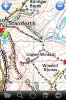
5. Lunch stop at Haworth. Basecamp says this about 3 hours into the trip, but that's without any stops so we should here at about 1pm I couldn't find anywhere where we could easily park all the bikes without paying near the Historic/interesting bit of Haworth (its the narrow cobbled street the Tour De France went up), so its either 80p for an hour at the top car park or slot bikes into free on street parking spaces, then its your time for an hour to look at historic Haworth and get some food. There's plenty of cafes, pubs and shops.
6. As we pull into Hawes we will stop at the filling station and then park up at the nearby bike parking near the Pennygarth cafe for any last minute shopping. Hardraw and the green dragon is only 10minutes/3miles away.

Sunday
1. I will decide soon if we are having breakfast at the Pub or getting it at Takoda camping. For those who went to the XRV national, Paul at Takoda did bacon butties and cups of tea at a very reasonable rate. Hopefully he will do the same again for us. Leave the Pub at 8.30 if we are going to Takoda, 9.30 if we are breakfasting at the pub.
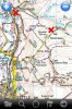
2. Lunch at Bellingham (pronounced Belling-Jam for the southerners). Same sort of plan as for Haworth excpet there should plenty of free on street parking around Bellingham, which isnt a very big place but there are 3 cafes and a couple of pubs plus a shop or two and some nice walks or places for a picnic in the town or just a few minutes away. This place looks interesting http://www.carriages-tearoom.co.uk/ but I am not really wanting to make a reservation for us all as timing is way too unpredictable and I am sure some will want to make/buy sandwiches and/or have some time off from the group.
3. Arrive Yetholm and the official end of the Pennine Way. There's not much here except a sign, a pub, and a sleepy village. So a few photos and a 15 minute ride to Wooler. My best estimate is that we should be probably around 4pm to 6pm depending on how often we stop, the weather, or unpredictable delays.
4. Arrive Wooler YHA. We should be there in good time to check in, get changed and showered and get together to plan the evening. The Youth Hostel will have a full Kitchen so if you want to do your own thing you can, or we could get a takeway - a chinese buffet for 10 usually goes a long way with a lot of choice.

Monday
1. Not a lot planned yet. If you need to get away to get home then just do your own thing. Otherwise I plan a lazy and slow start to the day with breakfast either at the YHA or a cafe in town.
2. I had suggested a trip to Holy Island which is only about 30mins away and I think safe crossing is after about 11am (there's a link in one of the threads somewhere). So we could have a mooch around there and then either a ride down the Northumberland coast - Bamburgh, Seahouses, Dunstanburgh, Craster, Alnmouth, Alnwick, OR head inland down the tweed valley and then follow the English/Scottish border on ace quiet roads across to the Carlisle area. Then its head North, South or West home.

I hope OK with everyone, shout up if you don't like it or have a specific request.
 

Lutin

Administrator
Staff member
Forum Supporter
Austin, that's sounds absolutely fantastic! Thanks hugely for taking the trouble to organise this. You are a star!

As for Monday, we're up for Holy Island - and the lazy start. :D I've booked us into the shepherd's hut for the Monday night as well - so we'll just be having a mooch around the area after Holy Island. Probably then heading into Scotland for a few days before catching a ferry and heading homewards. Best laid plans and all that........ ;)
 

austin

Well-Known Member
I called in to Takoda camping and met lovely Maria today. They will do breakfast sandwiches for us on Sunday. Bacon butty and tea will be £3.50, but they do sausage, egg, and every combination you can think of. It will take about an hour to get there from The green dragon so I said we would be there about 9.30.


Sent from my iPhone with a smile :)
 

austin

Well-Known Member
As it was a nice evening I had a ride to check out a green lane -Goat Scar Land, Stainforth. It's a lovely lane, mostly easy gravel twin track across fields or between walls except for two short steep rocky descents. I managed on the GSA fine, paddling it down one descent but ride it down the other. Not fine two up or heavily laden though. So, if anyone wants it, it's em route and we can meet at the bottom.


There's another green lane that had been suggested to me as being easy - just off the summit of Holme Moss. Anyone know it or fancy recceing it for me. I can send directions/ map. TA.


Sent from my iPhone with a smile :)
 

Attachments

  • ImageUploadedByTapatalk1405981956.832200.jpg
    ImageUploadedByTapatalk1405981956.832200.jpg
    81 KB · Views: 695
  • ImageUploadedByTapatalk1405981968.196201.jpg
    ImageUploadedByTapatalk1405981968.196201.jpg
    117.8 KB · Views: 714

austin

Well-Known Member
As it was a nice evening I had a ride to check out a green lane -Goat Scar Lane, Stainforth. It's a lovely lane, mostly easy gravel twin track across fields or between walls except for two short steep rocky descents. I managed on the GSA fine, paddling it down one descent but rode it down the other. Not fine two up or heavily laden though. So, if anyone wants it, it's en route and we can meet at the bottom.


There's another green lane that had been suggested to me as being easy - just off the summit of Holme Moss. Anyone know it or fancy recceing it for me. I can send directions/ map. TA.


Sent from my iPhone with a smile :)
 

austin

Well-Known Member
Photos again....


Sent from my iPhone with a smile :)
 

Attachments

  • ImageUploadedByTapatalk1405982138.150788.jpg
    ImageUploadedByTapatalk1405982138.150788.jpg
    81 KB · Views: 685
  • ImageUploadedByTapatalk1405982147.503603.jpg
    ImageUploadedByTapatalk1405982147.503603.jpg
    117.8 KB · Views: 655

Paul-S

Active Member
Forum Supporter
The Holme Moss lane is very easy - it's a gravel track wide enough for 2 cars to pass with the odd pothole here and there

It's just off the summit on the way to Holmefirth and a steeper section drops off to the right just on a bend but the lane can be accessed 50 metres along the road straight off the road
 
Top